


Hiking the Cornish Camino
The Saints Way

Please forgive the soupçon of literal redundancy in the title. Camino, meaning hike, trail or path, however I do like a little alliteration. I wrote this post the day after completing the hike. Today is threatening to pour with rain, typical weather for this time of year in Cornwall. The past two days, however, were a lovely anomaly, dry, providing just enough time to complete the journey in comfort.
The Saints Way, known locally as simply “The Way”, was established in 1986 as a re-creation of the journey that may have been travelled in the Bronze Age (1500 - 500 BC) to move metals across Cornwall to avoid the arduous sea route around Land’s End. A millennia later, in the Dark Ages (500-600AD), the path is purported to have been used by religious pilgrims from Ireland and Wales, en route to Brittany, and perhaps onwards to the Cathedral of Santiago de Compostale in Galicia, northern Spain. An excellent guide to The Way is available from Pelican Studio, it does a far better job of explaining the route than I would, so I will limit my musings to commentary on the qualities of my experience.
How much of The Way is actually the original route is up for scholarly debate, what you can be assured of, is you will pass many churches and a few pubs. Surprisingly few pubs in fact, maybe the pilgrims were sober folks?
The Saints Way is approximately 30 miles, crossing Cornwall coast-to-coast from the fishing town of Padstow to the mouth of the Fowey estuary. 30 miles is a challenging distance for my body. I have previously described hiking such a distance in a single day (Walking thirty miles in a day), but that ceased to be fun after a while. Breaking the trail into two days could cause them to be short days. I resolved the dilemma by extending the second day by an additional 5 miles, linking The Way to the South West Coast Path from Fowey to Polkerris. This decision did not disappoint, it was a stunning section to hike, and an excellent capstone to the journey.
The first day, from Padstow to Lanivet, highlighted the downside of this trail - the roads. Perhaps as much as 80% of the distance is covered walking on tarmac. For my American friends, tarmac is black-top, an unpleasant walking surface, unforgiving and repetitive in its hard consistency, it wears on my joints and tires my feet. It made me long for the undulating surface of woodland trails. Thankfully, the majority of the roads were quiet country lanes, with only an occasional mechanized vehicle to contend with.
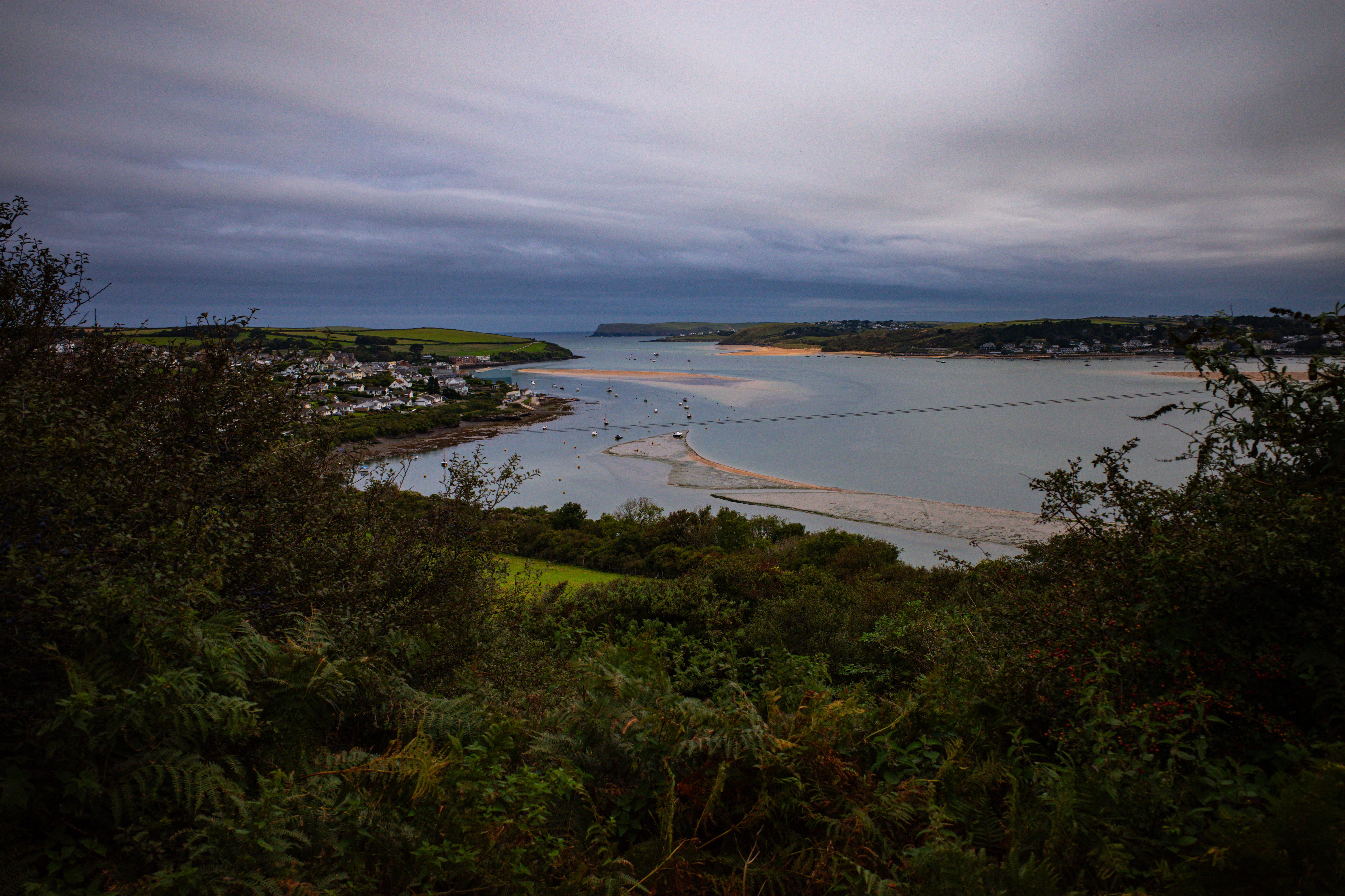
As I climbed through grassy green fields the view of the River Camel opened up, and I was treated to a distance glimpse of the spectacular Newland rock, proudly jutting out of the Celtic Sea like an ancient shark’s tooth.
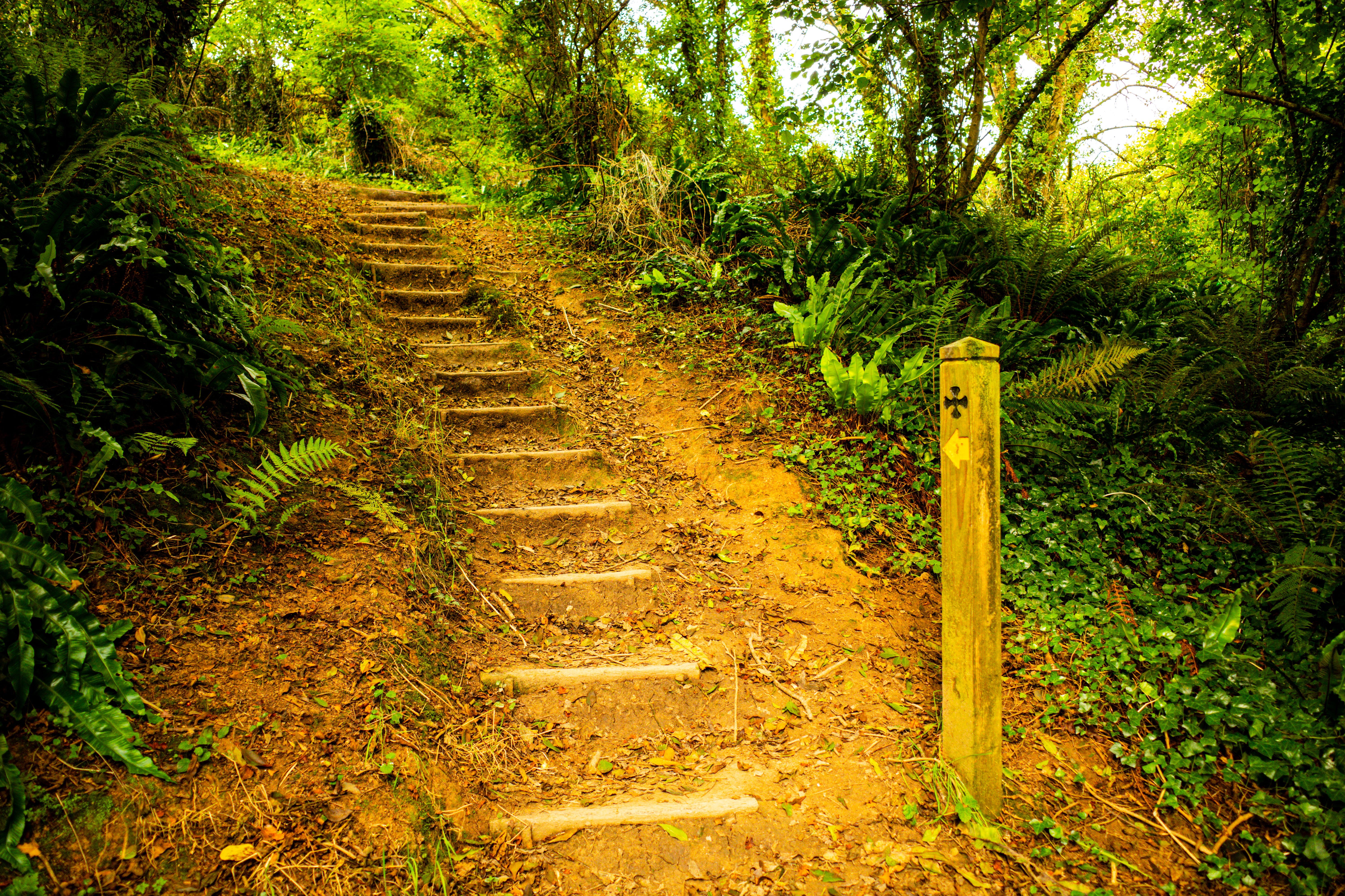
For several miles the trail descends and rises through valleys formed by the many tributaries of the River Camel. Each stream is crossed using small wooden bridges in various states of decrepitude. The trail is generally well marked with either wooden posts with an engraved cross, or finger signs bearing the trail’s name. Several sections that cross farm fields are not so well marked, which resulted in me taking a rather meandering route as I searched for the next stile.
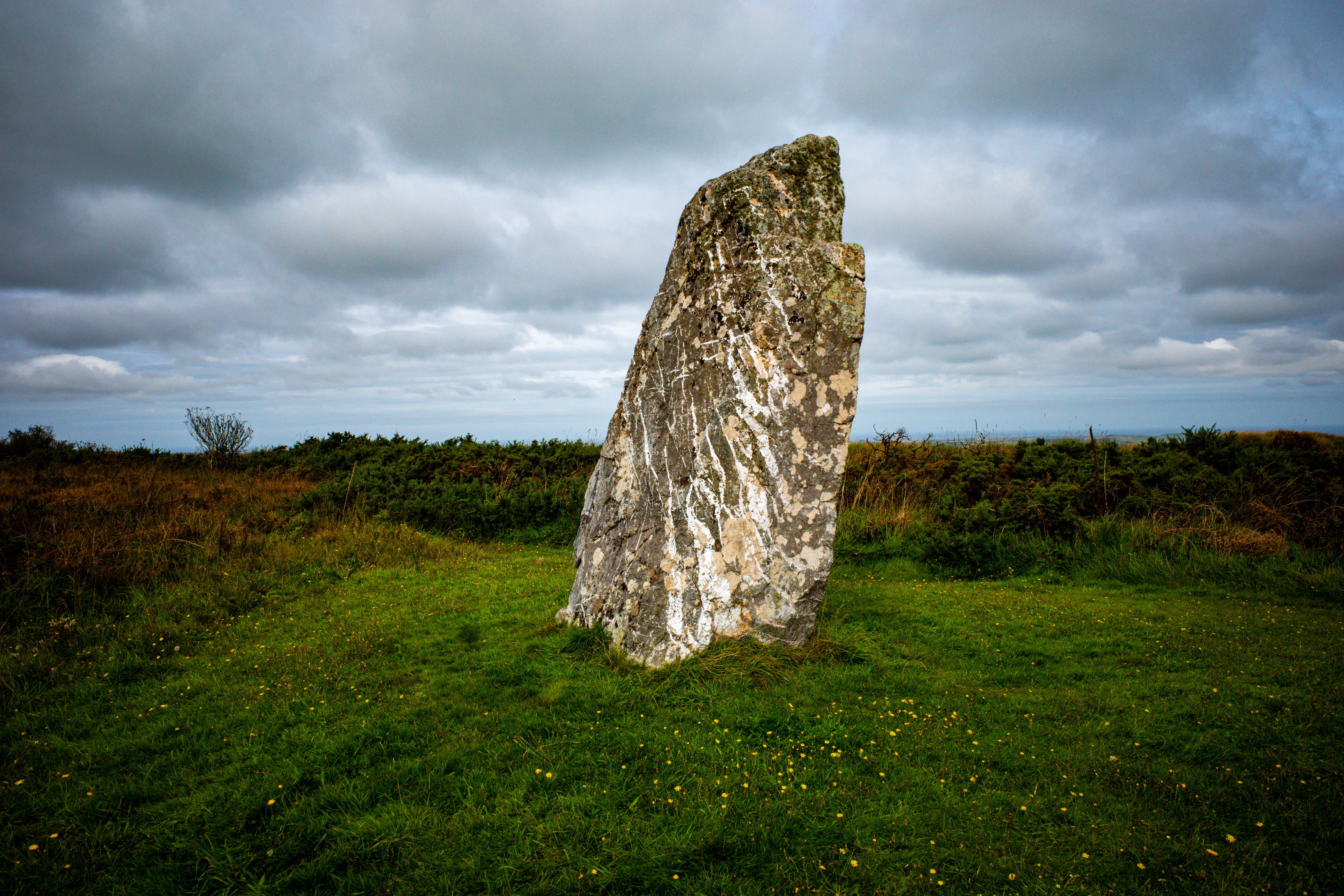
Many miles farther along The Way, magnificent views were delivered from the top of St Breock Downs, where there stands a Neolithic era (2500 BC) Monolith. A massive monument to who knows what or why. To the north the Cornish coast was clearly visible, as were the many miles of The Way behind and ahead of me.
The Way descends towards its midpoint at the village of Lanivet, were at last, an Inn resides. The Linet Inn surprised me, catering not just to my plant-based diet, but also having an excellent range of sober drinks. A sweet potato dahl, and several pints of NA beer later, I was satiated and satisfyingly stuffed.
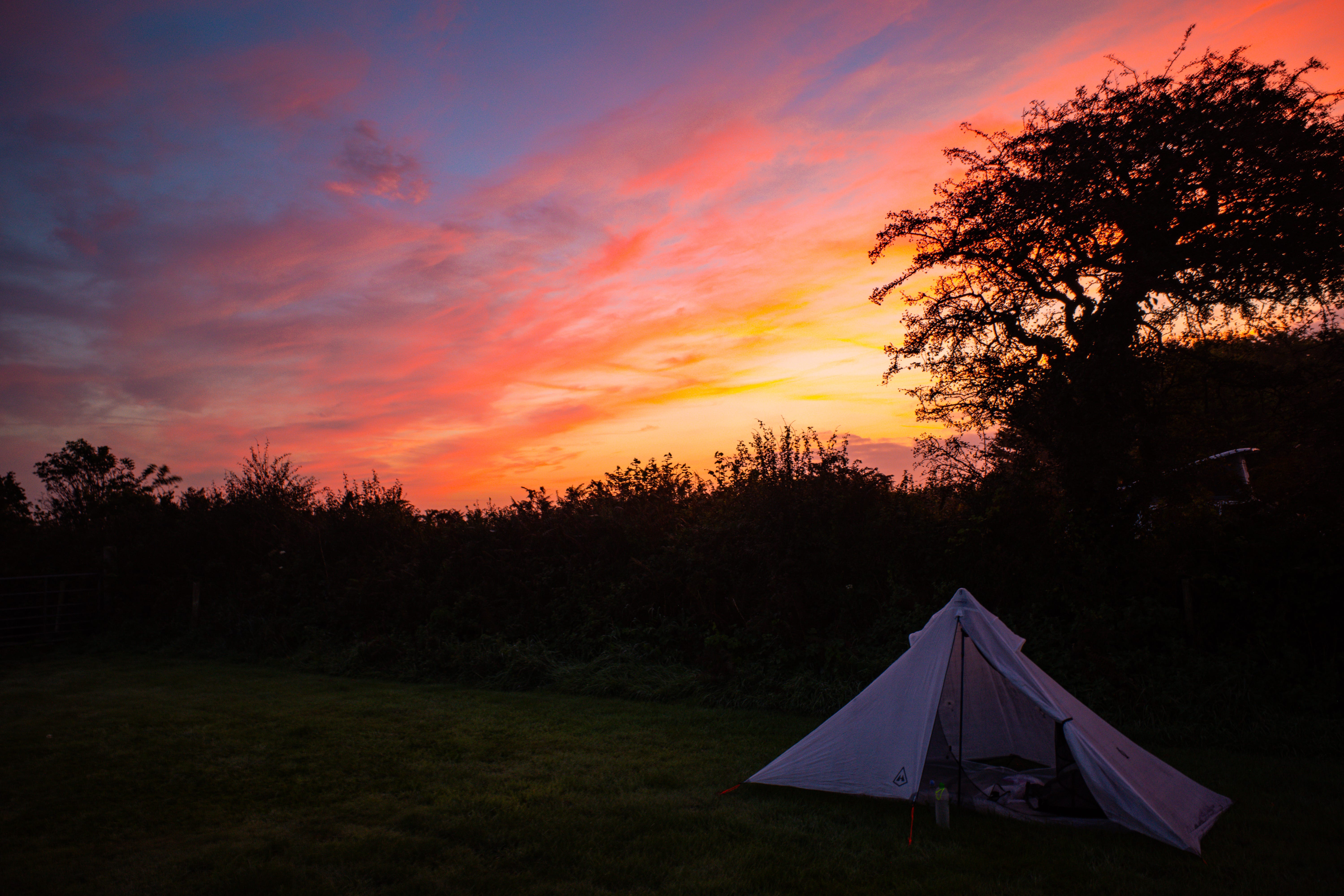
I arrived at the well-equipped Mena farm campsite mid-afternoon and spent a very pleasant evening watching the sun set behind the Cornish Alps.
I had chosen to carry and spend the night in a trekking pole tent, the Hyperlite Mountain Gear MID-1, an ultralight shelter which weighs only 16.8oz (476g). I found the tent easy to erect and adjust. It uses six tent stakes/pegs including the one to hold the doors open.
As with all tents, I experienced some condensation, which was no surprise when I woke and found myself surrounded by thick low cloud. The MID-1 uses a single trekking pole to create a pyramid structure (thus the MID name) supporting its single DCF wall. I found it was plenty roomy for one and was able to sit up and change clothes without touching the damp fabric. The tent seems thoughtfully designed and well built, I especially like design of the vestibules, doors, and bug net.
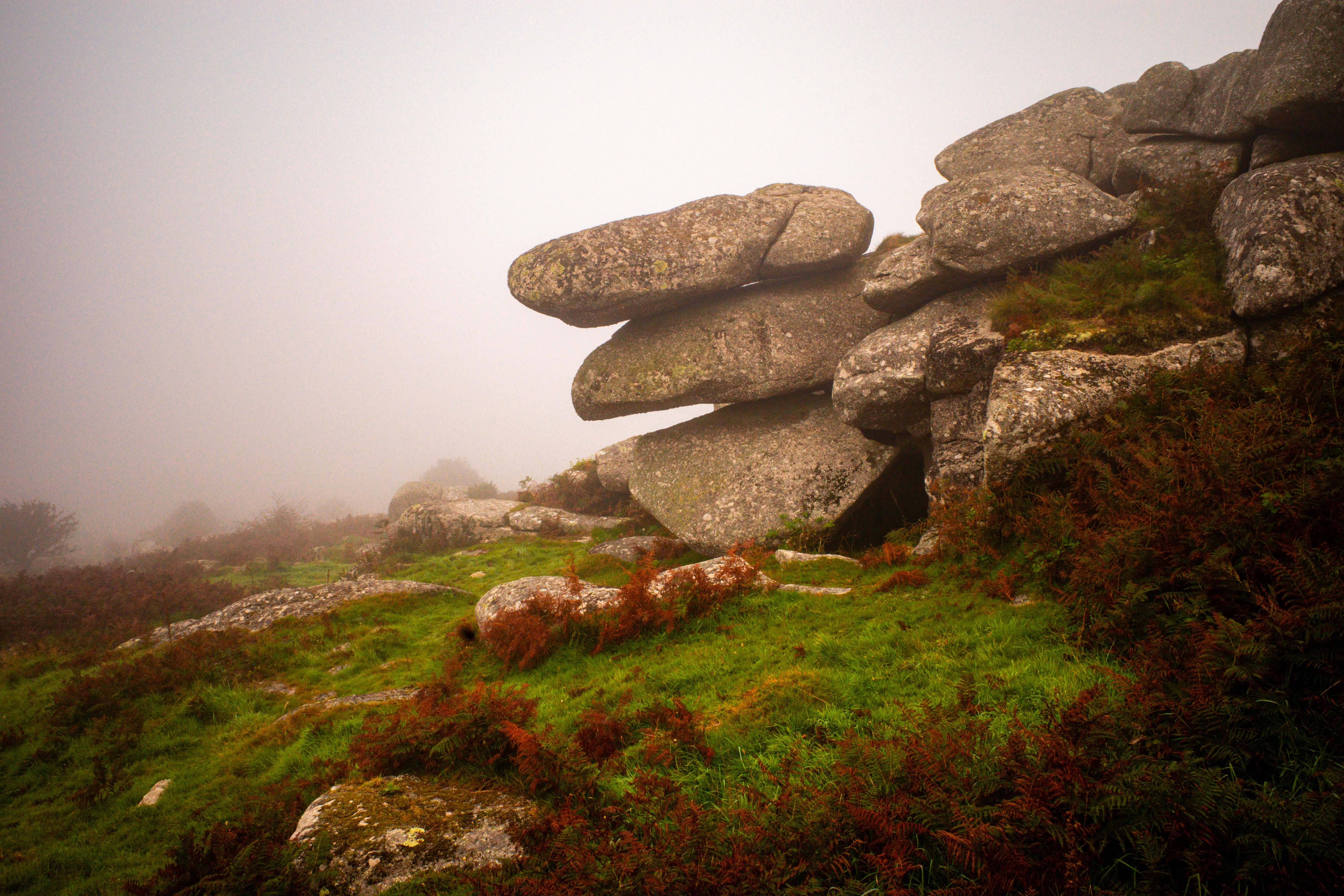
After breaking camp, I headed through the clouds to Helman Tor, hoping for great views to accompany my hearty breakfast munchies. Luck was against me as the clag remained, leaving me mired in a moist mantel of mist.
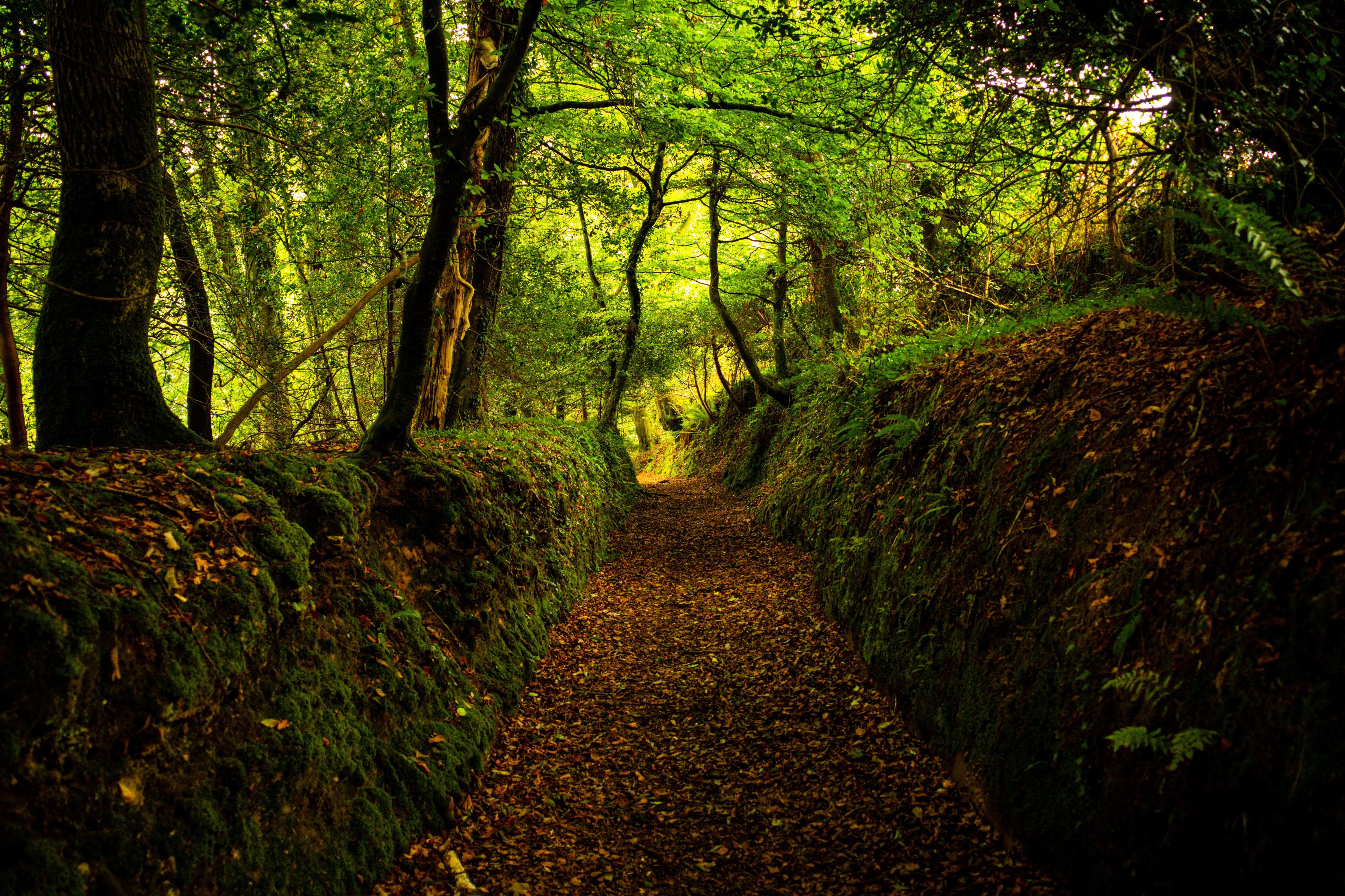
The next mile or so along the ancient ridgeway lanes was wonderful, soft underfoot, with steep granite hedgerows bordering Red Moor, replete with sheep, pheasant, and horses.
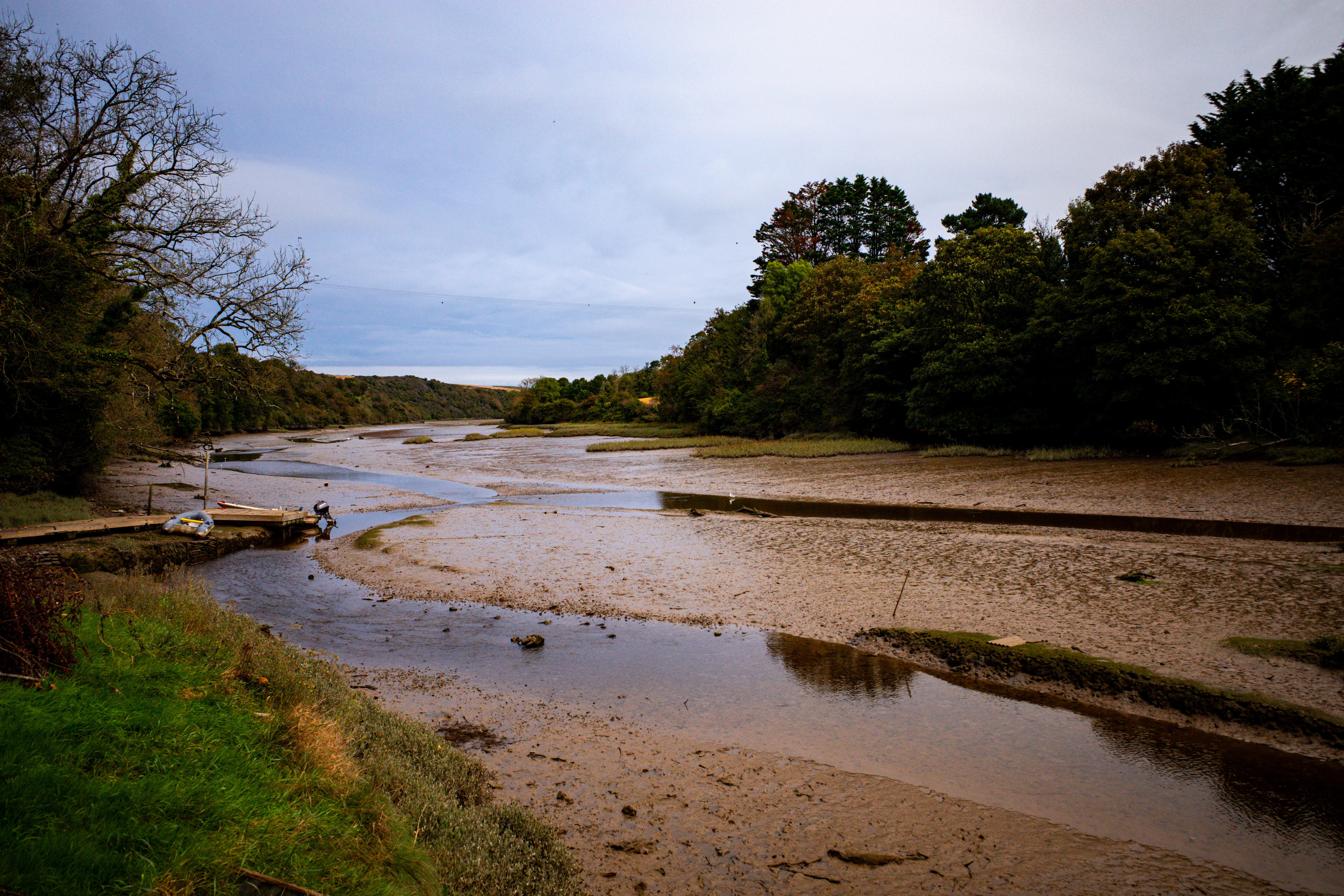
The Way struggles with it’s identity at times, it’s ancient roots/routes being tangled and obscured by the snaking modern highways that crisscross Cornwall. Vast quantities of road walking detract from the otherwise gorgeous landscapes. The walk along the busy A390 was a particularly low point on the hike. Lorries and cars whizzing by with little to no shoulder to take refuge on. Fortunately, the passage up and down the hilly fields to Milltown and Golant, and the subsequent serene walk through Colvithick woods pushed jousting with jalopies out of my mind as I soaked in the views of the river Fowey estuary.
The arrival into the town of Fowey felt familiar, as I returned to the hustle and bustle of modernity. The streets filling with the morning’s emmet migration as they emerged from their cozy nests to bask in the sunshine and snarf ice cream, and me, a grubby smelly walking alien, in search of a good coffee and a panini (try the Organicafé if you ever venture to these parts, great coffee and bread).
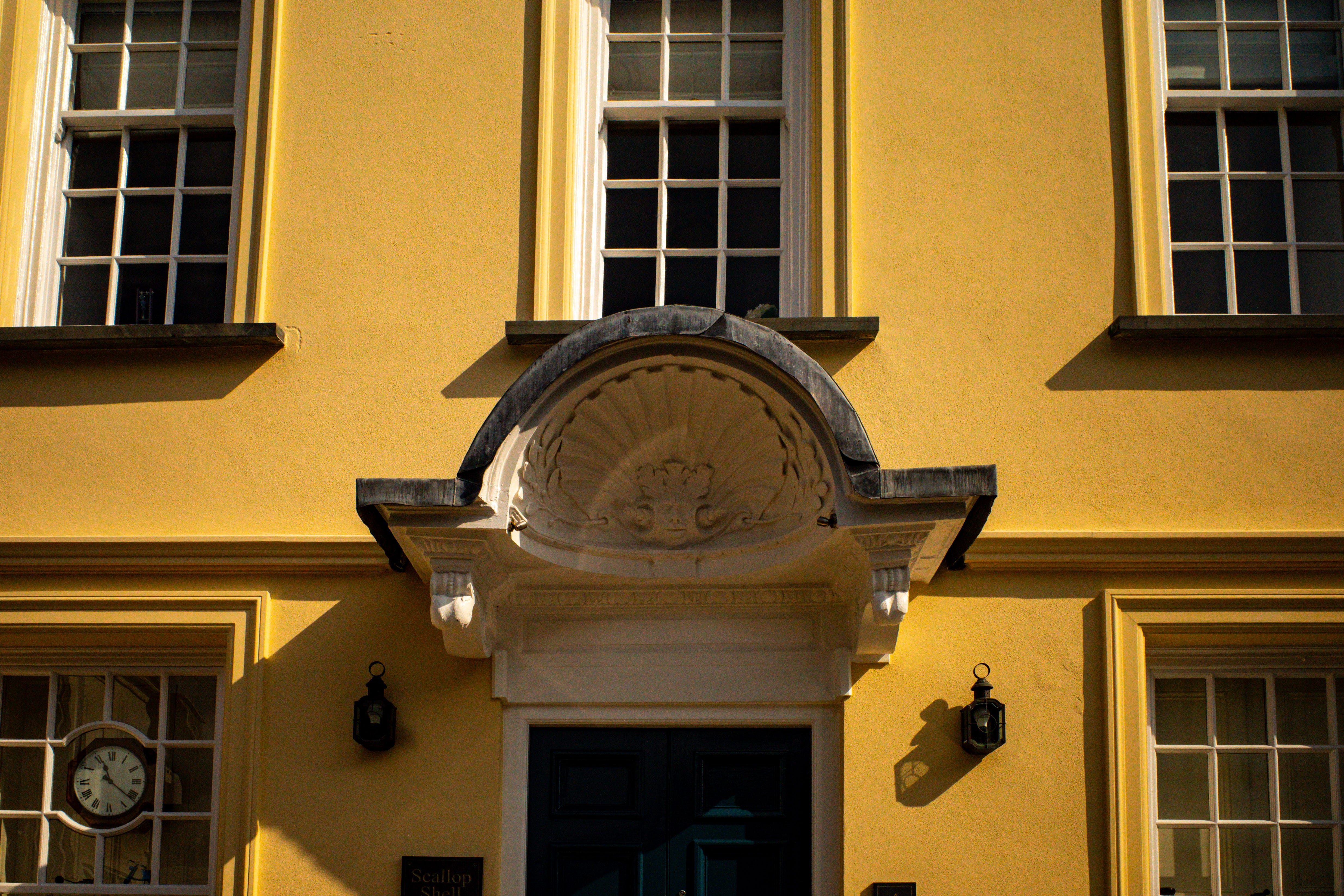
Walking the final mile of The Way I passed the inset Clam Shell marking the final pilgrim’s Inn, which according to lore provided pilgrims a refuge before they continued their Camino across France and Spain. The terminus, at the parish church, held little fanfare, as surrounded by a crowd of cornetto carriers I ended my “pilgrimage”.
Joining the South West Coast path is easy in Fowey. I followed the Esplanade until it descended to the beach at Readymoney Cove, from there the path rose swiftly up metal stairs to the crest of Saint Catherine’s Point, and onwards along the coast.
The path from Fowey to Polkerris can be summed up with one word “stunning”. Majestic cliffs, dramatic rocky shorelines, secret coves, and secluded swimming beaches, all accessible from an easy to follow and relatively gentle trail along the cliff tops.
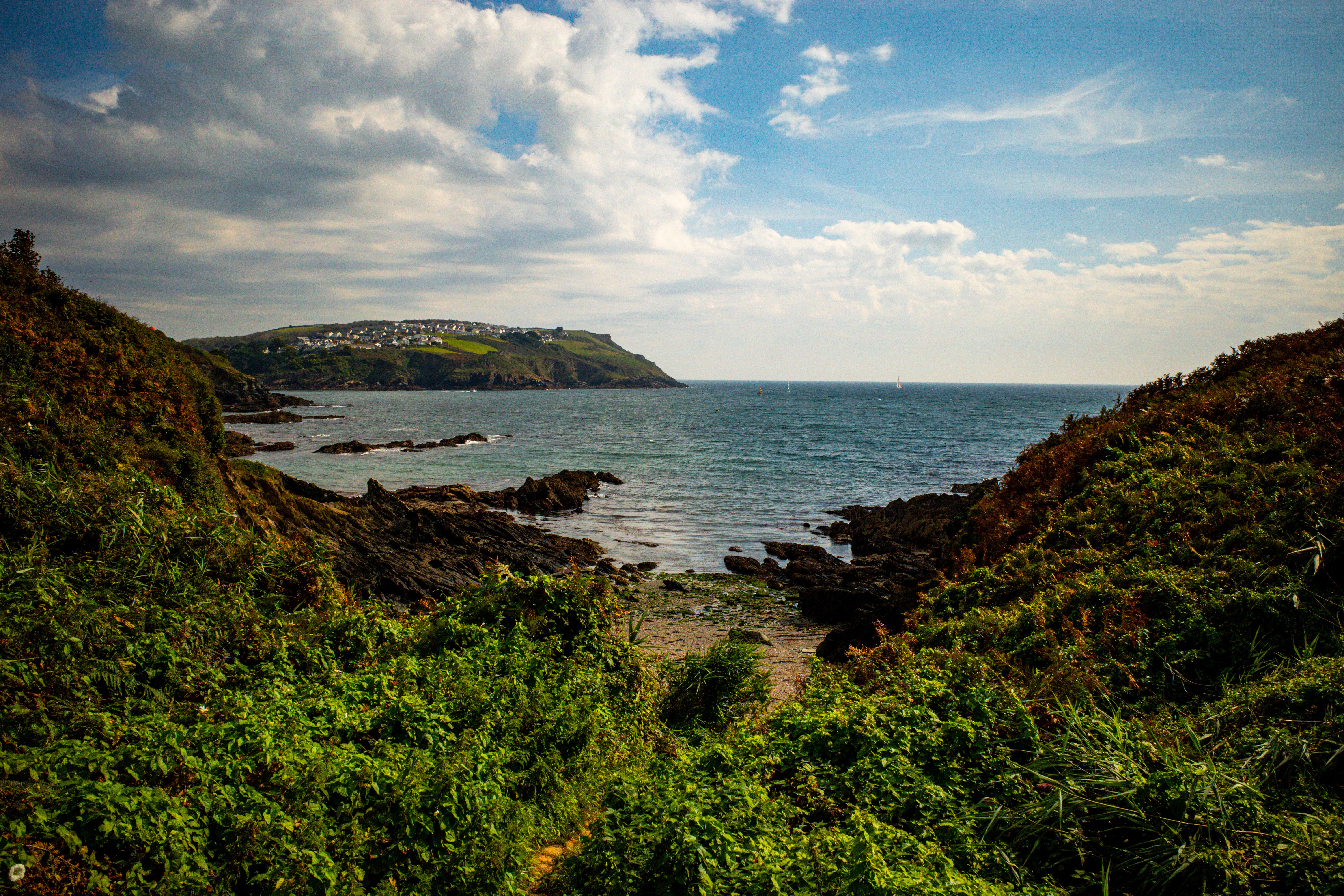
These five miles whetted my appetite for more of them - I’ll be back, but not to repeat the Cornish Camino - once is enough for the Tarmac Trail.